
YBYI: Bruny Island
- YBYI is a very old airstrip, dating back to at least 1965, which is the year of the earliest aerial photograph available on the LISTmap aerial photo viewer.
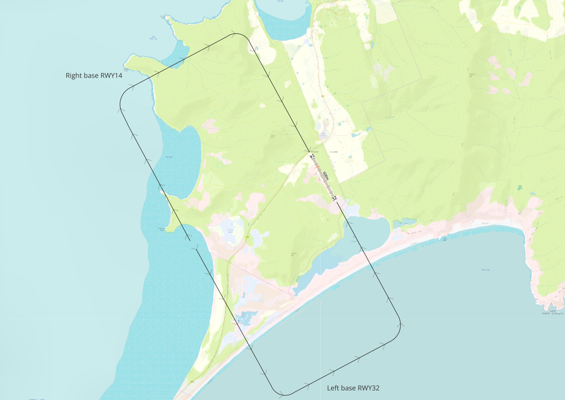
- Right hand circuits RWY14 due terrain

Notice
This website is intended as a guide. Landing area status and runway lengths may be incorrect. Check all information before departure with private owners and operators and against ERSA/NOTAMS, and overfly landing areas as required. CAAP 92-1 requires that except in an emergency, the consent of the owner/occupier is required before a landing area may be used. Certified and registered aerodromes are subject to copyright by Airservices Australia and only are provided. For more information on aerodrome categories refer to CASA Aerodrome Certification.
Sources

Base mapping data including topography, elevation (contours) and vegetation are sourced from theLIST (Tasmania). Mapping is also credit © OpenStreetMap contributors and through the Leaflet Open Source library for interactive maps (see Leaflet).
Google Earth views: Google, CNES/Airbus Data LDEO-Columbia, NSF, NOAA, US Navy, NGA, GEBCO Landsat/Copernicus TerraMetrics.
GIS mapping for this work is provided by QGIS.org, 2020. QGIS Geographic Information System. QGIS Association. http://www.qgis.org
Microsoft Flight Simulator 2020 and Google Earth are used to provide a general perspective on terrain around an aircraft landing area.